
Get ready for adventure, natural beauty, and plenty of scenic views! I’m excited to share my top 10 favorite hikes in Northwest Arkansas. As an outdoor enthusiast living in Fayetteville, I’ve explored the many excellent trails this region has to offer. From family-friendly walks to challenging climbs, Northwest Arkansas hiking has something for everyone.
The Ozark Mountains span much of the Natural State, with the Boston Mountains range cutting through the northwest. This ancient highland area boasts lush forests, rushing streams, majestic bluffs and breathtaking vistas. The unique rock formations and moderately challenging terrain make for exciting hikes. And with over 300 miles of trails, it may take more than one trip to experience them all!
Let’s explore my picks for the top 10 best hikes in Northwest Arkansas! 🥾
Table of Contents
Alum Cove Natural Bridge Trail ─ best hike in Arkansas

Trail Length: 1.9 km
Elevation Gain: 82 m
Route Type: Loop
Terrain Rating: Easy
Hike Time: 38 min
Dog Friendly: Yes
Recommended Seasons: Spring through fall
Get directions: Alum Cove Natural Bridge Trail on Google Maps
Features: Dogs on leash | Kid friendly | Hiking | Walking | Running | Forest | Wildflowers | Rocky
As you meander downhill early on, take time to enjoy the solitude and lush ferns. Cross a wooden footbridge over Little Piney Creek, then continue beneath a verdant canopy of oak, pine and maple trees. Get your camera ready when you reach the massive natural bridge carved out over millions of years by flowing water. 📸 Stand beneath the sandstone arch and look up in awe!
After taking some photos by the unique geological formation, complete the lollipop-style loop by hiking uphill and circling back. With relatively little elevation change, the Alum Cove Natural Bridge Trail works well for families and less experienced hikers.
Pro Tip: Come in the morning or on a weekday to avoid crowds by the natural bridge.
King's River Overlook Trail ─ Most scenic hike in NW Arkansas

Trail Length: 1.9 km
Elevation Gain: 44 m
Route Type: Out & back
Terrain Rating: Moderate
Hike Time: 44 m
Recommended Seasons: Year-round
Get directions: King’s River Overlook Trail on Google Maps
Features: Kid-friendly | Hiking | Bird watching | Running | Dog friendly | Forest | River | Views | Wildflowers | Rocky
For fantastic views of the lush King’s River valley and limestone bluffs, hike the scenic King’s River Overlook Trail. Located inside the Ponca wilderness area, this fairly steep 1.8-mile out-and-back trail delivers big scenic rewards.
From the trailhead off County Road 43, start switchbacking under the forest canopy. Ascend wooden and earthen steps to reach an open ledge overlooking verdant hills and the Kings River far below. 🔭 Bring binoculars to scan for wildlife and birds!
Continue climbing via switchbacks and stone steps to another stellar viewpoint. From here you can see an oxbow curve in the river and a railroad tunnel. Complete the challenging uphill hike, then carefully descend the stone steps on the return.
With an elevation gain over 600 feet, King’s River Overlook Trail provides a moderately strenuous hike. But the sublime vistas make it worth the effort!
Pro Tip: Hike early to beat the heat on this mostly exposed trail. Bring plenty of water too.
Lake Leatherwood Loop Trail

Trail Length: 6.9 km
Elevation Gain: 119 m
Route Type: Loop
Terrain Rating: Easy
Hike Time: 1 h 37 min
Dog Friendly: Yes
Recommended Seasons: Year-round
Get directions: Lake Leatherwood Loop Trail on Google Maps
Enjoy fresh air, wildlife and lush scenery along this easy woodland loop surrounding Lake Leatherwood. Located within the city park in Eureka Springs, the wide trail offers effortless hiking with plenty to see.
As you circle the calm lake, gaze across blue waters backed by forested slopes turning golden in autumn. Pass shady picnic areas and keep eyes peeled for local critters. A couple bridges cross over inlets, including one covered bridge reminiscent of Switzerland!
Near the halfway point, a short side trail leads uphill to Lake Leatherwood Dam. Enjoy sweeping views across the verdant valley before returning to complete the 1.9-mile loop. With minimal elevation change, the Lake Leatherwood Trail suits all hiking abilities.
Pro Tip: Pack a picnic to enjoy lakeside at one of the peaceful tables along this trail!
Pedestal Rocks Loop + Kings Bluff Extension

Trail Length: 4.0 km
Elevation Gain: 92 m
Route Type: Loop + out & back extension
Terrain Rating: Moderate
Hike Time: 1 1/2 hours
Dog Friendly: Yes
Recommended Seasons: Spring through fall
Get directions: Pedestal Rocks Loop on Google Maps
Features: Dogs on leash | Kid friendly | Hiking | Cave | Forest | River | Views | Waterfall | Wildflowers | Rocky | Scramble
Begin hiking clockwise on the Pedestal Rocks Trail, gently climbing wooden steps under the forest canopy. At the first junction, take a short detour left to see the precarious Balanced Rock. Back on the main trail, continue looping clockwise on more log steps to the northern point.
Scramble up the unofficial path to King’s Bluff vista for sweeping views across the Ozarks hills! 🌄 Descend carefully using roots and rocks as hand holds. Finish the hike by completing the Pedestal Rocks loop. With an added out and back to King’s Bluff extension, expect around 560 feet total elevation gain.
Pro Tip: Start early before the day hikers arrive and the weather gets steamy.
Round Top Mountain Trail

Trail Length: 5.6 km
Elevation Gain: 164 m
Route Type: Loop
Terrain Rating: Difficult
Hike Time: 3 hours
Dog Friendly: Yes
Recommended Seasons: Spring through fall
Get directions: Round Top Mountain Trail on Google Maps
Features: Dogs on leash | Kid friendly | Hiking | Bird watching | Forest | River | Views | Wildflowers | Wildlife | Rocky | Scramble
From the Round Top trailhead, start switchbacking relentlessly under the forest canopy. Huff and puff up wooden and soft earth steps etched into the hillside. Stop to catch your breath and take in glimpses of the Arkansas River Valley expanding below.
The grade eases briefly along the ridgecrest before one final push to the mountaintop. Emerging from the trees, soak up a sweeping 360° view across the Boston Mountains and plains beyond! Snap photos amid blooming wildflowers in spring and summer.
Descend using caution over uneven track and loose gravel. With an elevation gain over 1,300 feet, Round Top Mountain Trail is only for seasoned and surefooted hikers. But the panoramic payoff at the summit makes all the effort worthwhile!
Pro Tip: Bring trekking poles or a walking stick to ease the steep descent on tired legs.
Sam's Throne ─ top view of the northwest Arkansas

Trail Length: 4.7 km
Elevation Gain:120 m
Route Type: Out & back
Terrain Rating: Moderate
Hike Time: 1 h 14 min
Dog Friendly: Yes
Recommended Seasons: Year-round
Get directions: Sam’s Throne Trail on Google Maps
Features: Dogs on leash | Kid friendly | Camping | Hiking | Rock climbing | Bird watching | Forest | Views | Wildflowers | Wildlife | Rocky
Follow old logging roads gently uphill through oak and hickory forest. Cross Big Creek rock-hopping from stone to stone, then continue along the creek drainage. Pass mossy boulders and ledges to reach an offshoot trail leading right to Sam’s Throne.
Gaze up at the eroded bluff dwarfed by tall pines all around. Strike your royal pose seated atop the “throne” for a fun photo! 🤴 Return the same way bypassing small waterfalls and lush ferns in Big Creek gorge. With under 500 feet of elevation gain, Sam’s Throne Trail offers pleasant hiking to a quirky landmark.
Pro Tip: Wear water shoes or sandals to easily cross Big Creek without wet boots.
Tanyard Creek Loop ─ Waterfall lovers heaven

Trail Length: 3.1 km
Elevation Gain: 53 m
Route Type: Loop
Terrain Rating: Moderate
Hike Time: 44 min
Dog Friendly: Yes
Recommended Seasons: Year-round
Get directions: Tanyard Creek Loop on Google Maps
Features: Kid friendly | Hiking | Walking | Running | Cave | Dog friendly | Partially paved | Views | Waterfall | Wildflowers
Beginning from the Duck Pond Trailhead, follow the intermittent stream uphill through shady hardwood forest. At the junction, go right to start the clockwise loop on the Tanyard Creek Trail proper. More climbing on stone steps leads to an impressive gorge viewpoint.
As you descend, catch glimpses of tiny plunging waterfalls veiled by feathery ferns. Further downhill, approach the thundering 150-foot drop of majestic Tanyard Falls! Snap photos of water cascading over the sandstone cliff into emerald pools below. 💧
Cross the creek and finish the last uphill stretch, closing the loop where the two trails meet. With 850 feet of elevation change, bring hiking poles to ease the descent on knees. But with exceptional scenery throughout, the vigorous Tanyard Creek hike is worth every step!
Pro Tip: Visit midweek or early morning to avoid crowds at the waterfall viewpoints.
War Eagle Trail ─ NW Arkansas links

Trail Length: 2.6 km
Elevation Gain: 75 m
Route Type: Loop
Terrain Rating: Easy
Hike Time: 43 min
Dog Friendly: Yes
Recommended Seasons: Year-round
Get directions: War Eagle Trail on Google Maps
Features: Dogs on leash | Kid friendly | Camping | Hiking | Bird watching | Running | Cave | Forest | River | Views | Wildflowers | Muddy | Rocky
Begin at the War Eagle Mill site, today run by the Arkansas Parks service. Pop inside to see immense millstones grinding grains into flour and meal just like 150 years ago! Exit out back towards the riverside trail, descending steps to begin the flat forested loop.
Pass river access points perfect for fishing, wading or launching kayaks. If you’re lucky, glimpse playful river otters frolicking midstream! Complete the peaceful walk along the water’s edge, closing the loop across Highway 12.
With modest elevation change, the historic War Eagle Trail suits all ages and abilities. Come for the living history lesson…and stay for the otter spotting! 🦦
Pro Tip: Visit on a Saturday morning when the antique mill is operating. Time your hike to catch one informative guided tour explaining the milling process.
Read these for more adventurous hikes:
- 10 Best Hikes in Sedona
- 10 Best Hikes in Maui with Waterfalls
- Explore the Top 10 Best Hikes in Yosemite National Park: A Hiking Bucket List
- Discover the 10 Best Hikes in Oahu for Families: A Guide to Best Hikes on Oahu
- Best Hikes In Acadia National Park With Dogs [Dog Friendly Hiking Trails In Bar Harbor]
Whitaker Point

Trail Length: 4.3 km
Elevation Gain: 105 m
Route Type: Out & back
Terrain Rating: Moderate
Hike Time: 2 hours
Dog Friendly: Yes
Recommended Seasons: Year-round
Get directions: Whitaker Point Trail on Google Maps
Features: Dogs on leash | Kid friendly | Hiking | Cave | Forest | River | Views | Waterfall | Wildflowers | Wildlife | Rocky | Scramble
From the trailhead on Whitaker Creek Road, begin trekking uphill via switchbacks. Traverse wooded hillsides blanketed in wildflowers come spring. Emerge atop lofty Whitaker Point to soak up exceptional views in all directions!
Peer straight down the rugged bluff face into Arkansas’s emerald forest. Glimpse Lake Fort Smith shimmering in the distance beyond. But go easy near the cliff edges at this popular selfie spot! 📸 Complete the out-and-back retracing your steps downhill to finish.
With around 600 feet of elevation gain, Whitaker Point Trail feels moderately strenuous. But the supreme scenery hitting the cliff-top outlook makes every step worth the effort!
Pro Tip: Beat the crowds by hiking early on a weekday morning.
Yellow Rock Trail

Trail Length: 4.2 km
Elevation Gain: 147 m
Route Type: Out & back
Terrain Rating: Moderate
Hike Time: 1 1/2 hours
Dog Friendly: Yes
Recommended Seasons: Year-round
Get directions: Yellow Rock Trail on Google Maps
Features: Dogs on leash | Hiking | Horseback riding | Forest | River | Views | Rocky
The trail departs uphill from a roadside pullout on Scenic Byway 7. Ascend via switchbacks through shady oak and hickory stands, catching glimpses of limestone outcroppings. Emerge atop the Yellow Rock ledge to soak up exceptional river views! Look downstream over hills blanketed in autumn foliage. Scan across the forested canyon to spot Hawksbill Crag (Whitaker Point) in the distance.
Linger to enjoy the sublime scenery before carefully picking your way back down the rocky Yellow Rock Trail. Descent requires caution on loose gravel and uneven steps. But with only 600 feet of elevation gain, the short yet steep hike leads to one of the Buffalo National River’s best panoramas.
Pro Tip: Wear sturdy hiking shoes or boots to navigate the rocky trail without twisting an ankle. Treking poles also help steady progress uphill and down.
The Buffalo River Trail ─ you cant miss it

The Buffalo River Trail is located inside Buffalo National River State Park in northern Arkansas. This state park protects 135 miles of America’s first National River, the free-flowing Buffalo River. The Buffalo River Trail is one of the most popular trails, taking hikers along the bluff line with stellar views.
The trailhead for the Buffalo River Trail is located at Buffalo Point in the southern section of the park. Be sure to grab a trail map at the visitor center before starting out. This is an easy-to-follow trail that’s relatively easy for most fitness levels.
Part of the trail is called the Goat Trail where it hugs the bluff line just above the river. It’s aptly named as sure-footedness is needed in some sections along the steep terrain. But the Goat Trail rewards hikers with unparalleled views of the green-blue Buffalo River below and a glimpse of towering Bee Bluff across the river.
FAQs
What is the hardest hike in Arkansas?
The toughest hike in Arkansas is likely the Eagle Rock Loop, where you’ll need sturdy hiking boots to complete the 26-mile trail through the Ouachita National Forest and Arkansas’ Grand Canyon. The trail follows ridges, creeks, and the Upper Buffalo River, gaining over 9,000 feet in elevation change.
Does Arkansas have good hiking?
Yes, Arkansas has excellent hiking opportunities, especially in the Ozark and Ouachita mountains. Popular places to hike include the Buffalo National River, which features over 100 miles of maintained trails along the river and through stunning nature. We’ll explore trails like the Centerpoint Trail, where the trail starts with nice rock bluffs and views of the river.
What is the longest hiking trail in Arkansas?
The longest hiking trail in Arkansas is the Ouachita National Recreation Trail at 223 miles. It starts in the upper Buffalo River area and travels west through the Ouachita National Forest. Sections follow ridges and creeks, and it is considered a difficult hike.
Is Northwest Arkansas a good place to live?
Yes, Northwest Arkansas offers a great quality of life with access to culture, dining and entertainment in growing cities like Fayetteville and Bentonville, as well as ample hiking opportunities with over 40 miles of trails in Bentonville alone, including the popular Slaughter Pen Trail in the Blowing Springs park area. The Applegate Trail in Bentonville follows restored native landscapes along Little Sugar Creek Greenway.
What is the most photographed hike in Arkansas?
One of the most photographed hikes in Arkansas is the trail to Hawksbill Crag in the Upper Buffalo Wilderness, affectionately called the Arkansas Grand Canyon. The trail passes rock bluffs and ends at the dramatic rocky outcrop with cliff views of over 100 feet down to the river below.
How long is the Applegate Trail Bentonville?
The Applegate Trail in Bentonville is 1.79 miles one-way, making it easy to hike along and take the trail out and back for a nice day hike.
What trail goes to the highest point in Arkansas?
The trail to Magazine Mountain and Signal Hill climbs to the highest point in Arkansas at 2,753 feet. The hike starts from the Mossback Ridge Trailhead in the Ouachita National Forest.
How hard is the Ouachita Trail?
The Ouachita Trail is considered one of the toughest long-distance hikes in the country due to its length over 220 miles and cumulative elevation gain of over 30,000 feet. Most hike it in sections over time. Good gear and preparation are vital to hiking the Ouachita Trail.
What is the toughest hike in the world?
Among the universally considered toughest hikes is the Kalalau Trail in Hawaii along the Na Pali Coast on Kauai Island. Trail guide company Tim Ernst has written great trail guides like “Buffalo River Hiking Trails” and “Tim Ernst’s Buffalo River Hiking Trails,” focused on Buffalo National River trails and northern Arkansas.
Final Thoughts abot the Best Hikes in Northwest Arkansas
I hope you’re now inspired to explore Northwest Arkansas’s wealth of excellent hiking trails! 🥾🌲 From easy nature walks with the family to demanding summit climbs, the region truly offers superb trails for all interests and abilities. Just be sure to pack plenty of water, snacks, insect repellant and first aid essentials before hitting the paths.
As you enjoy getting back to nature Ozark-style, remember to Stay the Trail and adhere to Leave No Trace ethics during your adventures. Avoid shortcuts that contribute to erosion issues or damage delicate vegetation. Pitch in to pick up any litter spied along the way. And be respectful of wildlife habitats and other hikers you encounter.
Want to find even more of my favorite Natural State hiking trails? Let me know in the comments if you’d like to see posts spotlighting additional regions! I’m happy to share guides covering the best routes in Central Arkansas, the Ouachita Mountains, the Arkansas River Valley or elsewhere across our beautiful state. Just say the word and I’ll hit the trails to scout out more hidden hiking gems worth sharing here. See you on the paths! 👋

MARK RODRIGUEZ
Mark is an experienced backpacker who has completed several multi-day hikes, including the John Muir and Wonderland Trail. He is also a hobbyist photographer who delights in capturing the captivating essence of nature through his camera lens. Mark is passionate about environmental conservation and often volunteers for trail maintenance and clean-up projects.


Very nicely described best hikes in NW Arkansas. It has provoked the avid hiker inside me and I am planning to travel to these best hikes in NW Arkansas.
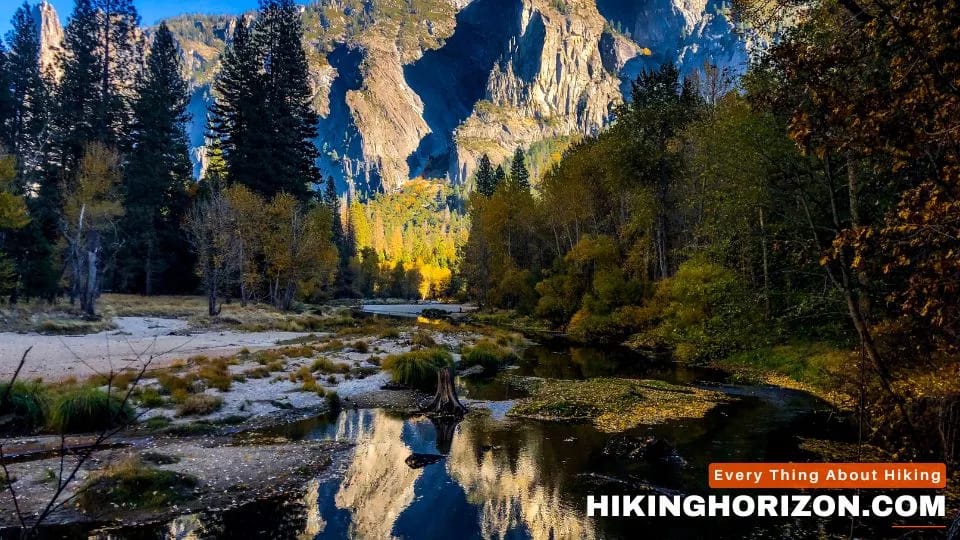
Ozark hikers bask in fall foliage even more brilliant than New England’s. Discover the jewels like Whitaker Point that make this a world-class outdoor paradise!
Ozark vistas bathed in fall foliage rival New England. Discover why they call these the Natural State’s jewels like Whitaker Point and Hawksbill Crag!
Hi, I want to say that this post is awesome nice written and come with approximately all significant infos I would like to peer extra posts like this
Wooded hills cloaked in crimson, gold and amber,
Rock bluffs towering above the winding Buffalo River’s azure waters,
Autumn in the Ozarks is a sight to behold along these peaceful trails.
Fabulous work. keep it up!!!