
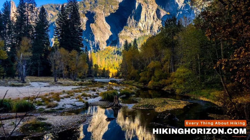
Tucked amid the red sandstone formations of northern Arizona lies the breathtaking city of Sedona. Known for its vibrant art scene, spiritual vortices, and jaw-dropping landscapes, Sedona attracts over 3 million visitors per year.
But it’s the boundless hiking trails that bring outdoor enthusiasts flocking to this Southwestern haven. With over 89 miles of trails winding through pine forests and desert terrain, Sedona serves up heart-pumping adventures for all levels.
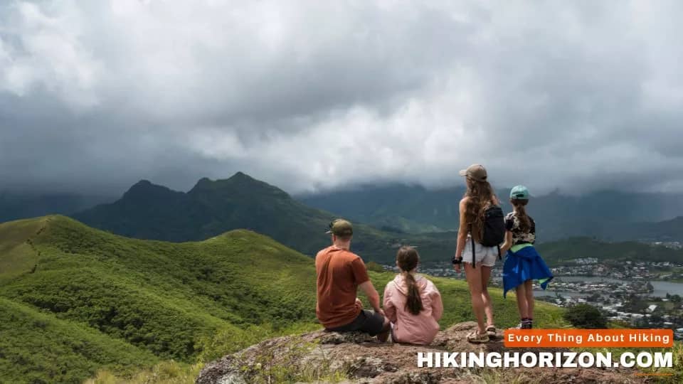
From easy nature walks to steep ascents up stone monoliths, here are the top 10 best hikes in Sedona. Whether you’re seeking sweeping views, a fun canyon scramble, or a spiritual vortex site, these trails highlight the very best of Red Rock Country.
Table of Contents
Bear Mountain Trail

Distance: 7.9 Km roundtrip
Elevation gain: 617 m
Road access: Paved road, 2WD vehicles
Pet friendly: Yes, leashed
Hiking: Moderate grade, Switchbacks
Views: 360° vistas, Red rock formations
Wildflowers: Spring blooms
Wildlife: Birds, Deer, Bear
Rocky/Scramble: Light scrambling to summit
Shade: No
Fee: No entrance fee
Round Type: Out & back
Trailhead location: Get Google Maps directions
Arguably one of the most popular hikes in Sedona, Bear Mountain Trail rewards ambitious hikers with far-reaching panoramas. The moderate 5.4-mile out-and-back route packs a good amount of uphill, gaining over 1,200 feet in elevation. But spaced-out switchbacks help ease the climb towards the open, mesa-topped summit. Gaze out over Sedona’s sandstone monoliths and painted desert from the pinnacle viewpoint.
For even broader vistas, connect via the Drinkwater Trail to Schuerman Mountain. Besides stellar scenery, you may also spot black bear, elk, and feathered species like red-tailed hawks along the piñon-dotted route. With access from a major road (89A) plus a relatively moderate grade, Bear Mountain stands out as a can’t miss for panorama lovers.
Bell Rock Trail

Distance: 1.3 Km roundtrip
Elevation gain: 62 m
Road access: Paved, suitable for all vehicles
Dogs on leash: Yes
Kid-friendly: Yes
Hiking: Easy, Moderate, Strenuous
Walking: Paved sections, Flat
Running: Hardpack dirt, Rolling hills
Views: River, Canyon, Red rocks
Rocky/Scramble: Light, Moderate, Heavy
Shade: No
Fee: Entrance fee
Trailhead location: Get Google Maps directions
Named for resembling a bell, the iconic Bell Rock features prominently along this Sedona hiking trail network. The main route stretches 3.6 miles round trip, delivering moderate exercise with little elevation change. It’s suitable for most fitness levels. You’ll skirt through Oak Creek canyon, then traverse the base of the famous vortex site while soaking up views.
From the Bell Rock Trailhead, additional paths split off to loop around Courthouse Butte, climb higher onto the formation, or access the creek. So you can customize distance and difficulty to your ability or timeframe. While the area stays busy, the peaceful creekside landscapes coupled with looming red rock structures never get old. It’s easy to see why Bell Rock ranks among the most popular places to hike in Sedona.
Birthing Cave

Distance: 3.1 Km roundtrip
Elevation gain: 72 m
Road access: Dirt, high clearance vehicle recommended
Dogs on leash: Yes
Hiking: Easy, Moderate, Strenuous
Cave: Ancient dwelling, Rock formation
Views: River, Canyon, Red rocks
Rocky/Scramble: Light, Moderate, Heavy
Off-trail: Bushwhacking required
Trailhead location: Get Google Maps directions
At just under a mile round trip, Birthing Cave makes for one of Sedona’s shortest yet sweetest hikes. Tucked high up a slick rock canyon, this little-known trail provides early Native American history in a dramatic, secluded setting.
A short stint of uphill climbing leads to the natural “birthing cave” itself. Interior handholds indicate its use for female ceremonies long ago. Enjoy a quiet ponder, then continue further to an overlook of the lush canyon below. While more strenuous hikes abound, the cultural allure surrounding Birthing Cave creates a worthy incentive to visit. And you’ll enjoy having Cathedral Rock as an idyllic backdrop.
Boynton Canyon Trail

Distance: 11.6 Km roundtrip
Elevation gain: 294 m
Road access: Dirt road, high clearance vehicle strongly recommended
Hiking: Easy, Moderate, Strenuous
Dogs on leash: Yes
Historic site: Ruins, Petroglyphs, Old passage
Kid-friendly: Stroller accessible
Views: River, Canyon, Red rocks
Fee: Entrance fee amount
Rocky: Light, Moderate, Heavy
Trailhead location: Get Google Maps directions
Enveloped within towering canyon walls, the trek through Boynton Canyon transports hikers into a fantasy landscape. The 6-mile out-and-back hike stays easygoing for most of the way, with relatively mellow elevation changes along Oak Creek. Dip beneath soaring rust-colored cliffs and weave through a lush riparian habitat bursting with flora and fauna.
About 2 miles in, you’ll reach the famed Kachina Woman vortex site. Here, Further on, a trail spur tackles the prominent knoll called Boynton Vista for panoramic views. Ambitious hikers can continue all the way to Schuerman Mountain along connecting routes for longer distances. With red rock scenery at every turn, Boynton Canyon is undoubtedly among the most scenic places to hike in Sedona.
Cathedral Rock Trail

Distance: 1.9 Km roundtrip
Elevation gain: 226 m
Road access: Dirt, high clearance vehicle recommended
Dogs on leash: Yes
Hiking: Easy, Moderate, Strenuous
Views: River, Canyon, Red rocks
Rocky/Scramble: Light, Moderate, Heavy
Trailhead location: Get Google Maps directions
The postcard-famous spire known as Cathedral Rock towers 500 feet over Oak Creek, beckoning hikers to come enjoy unique perspectives. At just 1.2 miles round trip, this short trail feels bigger than its length would suggest. That’s because reaching the “saddle” viewpoint between the twin rock towers involves a steep, thrilling scramble up slippery red rocks.
While the Cathedral Rock hike isn’t long, it packs a lot of challenge and adventure into a small package. As you climb higher using hands and feet, the views expand until you reach the climactic vista point. Gaze down upon the creek gorge and Back O’ Beyond area framed by soaring canyon walls. With both difficulty and scenery dialed up to 10, Cathedral Rock offers one of the most classic Sedona experiences.
Fay Canyon Trail

Distance: 3.9km roundtrip
Elevation gain: 91 m
Road access: Dirt road, high clearance vehicle recommended
Dogs on leash: Yes
Kid-friendly: Stroller accessible
Hiking: Easy, Moderate, Strenuous
River: Creek Access
Views: Canyon, Red rocks, Mesas
Wildflowers: Spring blooms
Wildlife: Birds, Deer
Rocky/Scramble: Light, Moderate, Heavy
Trailhead location: Get Google Maps directions
Nestled south of Sedona proper, the Fay Canyon area sees fewer crowds yet boasts similarly inspiring landscapes. The 2-mile Fay Canyon Trail loops through a pristine riparian environment with options to extend your hike. Gaze at soaring Capitol Butte from the canyon floor while admiring thickets of vibrant wildflowers in spring.
As a relatively flat, easygoing path, Fay Canyon works well for hiking with kids or dogs. You’ll enjoy tranquility accented by birdsong and the gentle babble of Oak Creek. Late summer brings catch-and-release creek fishing for native species like speckled dace. For a peaceful nature retreat minus the bustling trailheads of uptown, the Fay Canyon area offers hiking rejuvenation with moderate effort.
Little Horse Trail

Distance: 6.9 km roundtrip
Elevation gain: 188 m
Road access: Dirt road, high clearance vehicle strongly recommended
Dogs on leash: Yes
Kid friendly: Yes
Backpacking: Multi-day access
Hiking: Easy, Moderate, Strenuous
Horseback riding: Equestrian permitted
Mountain biking: Singletrack, Hills
Walking: Paved sections
Running: Hardpack dirt
Views: Canyon, Red rocks, Mesas
Wildflowers: Spring blooms
Wildlife: Birds, Deer, Bear
Shade: No, Exposed terrain
Trailhead location: Get Google Maps directions
In an area rife with novice hikers, Little Horse Trail provides a local favorite for easygoing walks with riparian beauty. Oak Creek flows directly alongside the well-defined dirt path, which stays nearly flat for its entirety. The shaded setting beneath a lush tree canopy keeps things cool on hot days. And you’re treated to great views of Capitol Butte’s towering red cliffs across the creek.
At just 1.5 miles in, the trailhead for the Secret Canyon Trail junctions off if you want to extend your journey. Otherwise, turn around at 3 miles once you pass a dramatic bend in the waterway marked by small rapids. With family-friendly qualities, this is one of the most relaxing places to hike in Sedona.
Sedona Airport Loop Trail

Distance: 5.3 km loop
Elevation gain: 131 m
Road access: Paved road, suitable for all vehicles
Dogs on leash: Yes
Hiking: Easy, Moderate, Strenuous
Walking: Flat terrain
Running: Hardpack dirt
Views: Canyon, Red rocks, Mesas
Wildflowers: Spring blooms
Wildlife: Birds, Deer
Rocky: Light, Moderate, Heavy
Trailhead location: At the Sedona-Oak Creek Airport. Get Google Maps directions
As one of the top easy hikes in Sedona, Airport Loop Trail traces gently rolling terrain with unlimited scenery. The well-defined double-track trail contours the foothills and washes of Airport Mesa, delivering stellar panoramas in all directions. Kick back and admire the sandstone monoliths including Coffee Pot Rock, Thunder Mountain, and Chimney Rock from the rolling grassland path.
clocking in at 4.3 miles, Airport Loop also works for trail running, birding, or leashed dog walks. And if you time it right, you can watch small aircraft take off and land at the adjacent airport overlook. With minimal effort required, Airport Loop lets you soak up Sedona’s scenery at your own relaxed pace. It’s perfect for cushioning longer, tougher hikes elsewhere.
Sugarloaf Loop Trail

Distance: 3.2 km loop
Elevation gain: 115 m
Road access: Dirt road, high clearance vehicle recommended
Dogs on leash: Yes
Kid friendly: Yes
Hiking: Easy, Moderate, Strenuous
Mountain biking: Singletrack, Hills
Walking: Paved sections
Running: Hardpack dirt
Views: Canyon, Red rocks, Mesas
Wildlife: Birds, Deer
Trailhead location: Get Google Maps directions
Tucked off the beaten path below Wilson Mountain lies this easily overlooked gem called Sugarloaf Loop. Spanning just over 2 miles, it packs stunning payoffs into a small, rolling circuit suited for most ability levels. You’ll skirt the base of Sugarloaf Rock, a knobby sandstone dome with a faint resemblance to its sweet namesake. Oak Creek serenades you the whole way, adding canyon views from the creek gorge overlook.
Wildflowers carpet the path after ample winter rains, while summer brings sun-dappled shade along the creekside stretches. With a mellow mix of exercise difficulty, the Sugarloaf Loop is one of the best shorter places to hike in Sedona. It doubles as a wonderful leg-stretcher after long days stuck in the car.
Soldier Pass Trail

Distance: 7.2 km roundtrip
Elevation gain: 256 m
Road access: Dirt road, high clearance vehicle strongly recommended
Dogs on leash: Yes
Kid friendly: Yes
Hiking: Easy, Moderate, Strenuous
Cave: Ancient dwelling, Formation
Forest: Pine, Oak, Riparian
River: Creek Access
Views: Canyon, Red rocks, Mesas
Rocky/Scramble: Light, Moderate, Heavy
Trailhead location: Get Google Maps directions
Of all the trails in and around Sedona, few compare to the adventure awaiting along Soldier Pass. The 4-mile trek packs history, scenery, and just enough spice to quicken your pulse without turning overly strenuous. Sections involve light rock scrambling and narrow ledges overlooking sheer canyon walls—just enough to instill excitement en route to the turnaround point.
You’ll also navigate the historical Soldiers Pass itself. Hewn from cliffs by indigenous Sinagua people long ago, the human-made passage granted quicker access between canyons for hunting or gathering needs. Today, it delivers one of Sedona’s most memorable hikes. Spectacular scenery of Seven Sacred Pools coupled with the thrill of canyon ledges makes Soldier Pass a can’t-miss adventure hike close to town limits.
Frequently Asked Questions (FAQs)
Where is the best place to hike in Sedona?
Some of the most popular and scenic trails are located in Oak Creek Canyon and West Fork areas, such as Devil’s Bridge, Cathedral Rock, and West Fork Trails. These provide stunning red rock views and creek access.
How hard is the Cathedral Rock trail?
The hike to Cathedral Rock Saddle is rated moderate-to-difficult, with steep slickrock scrambling to reach the viewpoint. It’s only 1.2 miles roundtrip but requires sure footing and height comfort.
What is the most scenic place in Sedona?
Many consider Red Rock State Park to be one of the most scenic natural areas, thanks to the stunning contrasts of sandstone formations bordering Oak Creek’s riparian greenspace.
What is the most popular hiking trail in Arizona?
The Bright Angel Trail leading into Grand Canyon is considered Arizona’s most popular hike. For Sedona specifically, Cathedral Rock, Devil’s Bridge, and Bell Rock are among the most visited.
What is the easiest hiking trail in Sedona?
Some of the easiest yet scenic Sedona hikes are along Soldier Pass, Airport Mesa Loop, Jordan Trail, and Little Horse Trail – all rated easy-to-moderate but with classic red rock scenery.
What is the name of a famous hiking trail in Arizona?
Arizona has many famous hikes like Bright Angel at Grand Canyon, The Wave in Vermilion Cliffs, and Camelback Mountain in Phoenix. Sedona’s Cathedral Rock and Devil’s Bridge hikes are also iconic.
What is the best month to hike in Sedona?
Spring (April-May) and fall (September-November) are considered the best times for hiking in Sedona, with milder temperatures and fewer crowds than summer.
Where is the strongest vortex in Sedona?
Some believe the strongest energy vortex areas are located near Airport Mesa, Cathedral Rock, Bell Rock, and Boynton Canyon – popular hiking trails lead to these sites.
How long does the Devil’s Bridge hike take?
The out-and-back hike to Devil’s Bridge is 4 4-mile round trip and takes roughly 2-3 hours with moderate fitness levels and trail conditions. Arrive early as parking fills.
Conclusion: Best hikes in sedona
With nearly 100 miles of trails showcasing some of Arizona’s most spectacular terrain, Sedona serves up boundless hiking possibilities. Whether you prefer easy nature rambles or ambitious summit pursuits, red rock vortices or riparian creekside settings, this guide covers the 10 best hikes suited for every interest and ability level. Just come prepared with sturdy footwear, water, and camera to capture the majesty of Sedona’s one-of-a-kind trail network!

SARAH LEE
Sarah has been hiking for over five years and is passionate about promoting the mental and emotional benefits of spending time in nature. She has written several articles on the topic and strongly advocates hiking as a form of therapy. Sarah is also a certified yoga instructor, often incorporating yoga and mindfulness practices into her hiking trips. She is dedicated to providing accurate and up-to-date information on trail conditions, difficulty levels, and must-see sights.

Sedona is a haven for hikers, with countless trails winding through stunning red rock formations. This blog post perfectly captures the diverse landscapes that make hiking here an unforgettable visual feast.
From desert vistas to creekside oases, the views look absolutely breathtaking along every recommended route. I really can’t wait to experience these trails firsthand someday and fully immerse myself in Sedona’s picture-perfect natural beauty on each step of the way.
Thank you Mia!
Your way of appreciation is as beautiful as your name.
Very informative and nicely crafted article on my favorite trails.
Wow, this article on the 10 Best Hikes in Sedona is an absolute gem! As someone who loves outdoor adventures, I appreciate the detailed descriptions of each trail, including distance, elevation gain, and road access. The stunning visuals and insider tips make me want to pack my bags and head straight to Sedona. Kudos to Hiking Horizon for providing such valuable information for hiking enthusiasts like me!
Wow, the 10 Best Hikes in Sedona article on Hiking Horizon is a treasure trove of information for outdoor enthusiasts like me! I’ve always been captivated by Sedona’s stunning landscapes, and now I have a list of the top hikes to explore. The detailed descriptions, trail distances, elevation gains, and even pet-friendly options are incredibly helpful. I can’t wait to embark on these adventures and experience the panoramic views, desert terrain, and spiritual vortex sites that Sedona has to offer. Thank you, Hiking Horizon, for this fantastic resource!
Like a painting of the Southwest come to life,
Sedona’s red rock trails captivate all who wander here.
Late day sun bathes towering formations in golden hues,
Whilescattered ruins whisper of those who came before.
I loved even more than you will get done right here. The overall look is nice, and the writing is stylish. I will definitely be back again and again if you keep posting such articles.